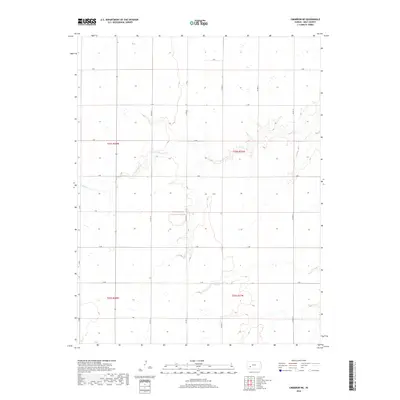
2018 Map of Cimarron NE
USGS Topo · Published 2018About this map
Buckner Cr meanders across this rural section of Gray County, defining the local hydrology within the High Plains. The landscape is organized by a precise grid of section lines and county thoroughfares, including Co Rd 19, Co Rd 20, and Co Rd 23, which facilitate access across the expansive agricultural allotments. These township boundaries, marked by t24s r28w and t24s r27w, reflect the systematic settlement patterns of western Kansas. While primarily an open landscape, the presence of smaller secondary routes such as D RD and E RD suggests the connectivity between isolated farmsteads and the broader regional network. This 2018 survey provides a clear view of the modern land management and drainage patterns that characterize this part of the state.
Find a feature on this map
19 named features on this map. Tap any name to fly to it.
Don’t see what you’re looking for? This feature index may not catch every label — zoom into the map to look around manually.
Map Details
Editions of this 2018 Cimarron NE Map
This is the sole edition of this map. No revisions or reprints were ever made.
Other maps of this area

1892 · Dodge
USGS Topo · 1:125,000

1955 · Dodge City
USGS Topo · 1:250,000

1955 · Scott City
USGS Topo · 1:250,000

1958 · Dodge City
USGS Topo · 1:250,000

1958 · Scott City
USGS Topo · 1:250,000

1959 · Dodge City
USGS Topo · 1:250,000

1968 · Cimarron NW
USGS Topo · 1:24,000

1968 · Ingalls
USGS Topo · 1:24,000

1968 · Dodge City NW
USGS Topo · 1:24,000

1968 · Cimarron
USGS Topo · 1:24,000