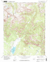
1973 Map of Cimarrona Peak
USGS Topo · Published 1975About this map
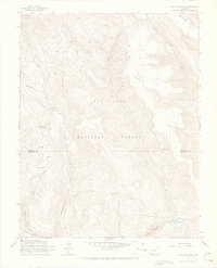
Williams Creek Reservoir sits at the heart of this high-altitude landscape, serving as a primary point of interest for back-country navigation in the early 1970s. The terrain is split between the Rio Grande National Forest and San Juan National Forest, divided by the winding path of the Continental Divide. This survey highlights the infrastructure of mid-century recreation and land management, featuring several established campsites like Cimarrona Campground and the Middle Fork Hunter Campground. Extensive pack trails, such as the Indian Creek Pack Trail, connect remote features like Hossick Lake and the high summit of Cimarrona Peak. The map captures the area before modern developments, showing the exact placement of a Gaging Sta and a Boat Ramp that defined local access to the watershed and the headwaters of the Middle Fork Piedra River.
Find a feature on this map
30 named features on this map. Tap any name to fly to it.
Don’t see what you’re looking for? This feature index may not catch every label — zoom into the map to look around manually.
Map Details
Editions of this 1973 Cimarrona Peak Map
4 editions found
Other maps of this area

1905 · San Cristobal
USGS Topo · 1:125,000

1907 · San Cristobal
USGS Topo · 1:125,000

1924 · Pagosa Springs
USGS Topo · 1:125,000

1927 · Pagosa Springs
USGS Topo · 1:125,000

1945 · Durango
USGS Topo · 1:250,000

1953 · Durango
USGS Topo · 1:250,000

1954 · Durango
USGS Topo · 1:250,000

1961 · Durango
USGS Topo · 1:250,000

1963 · Durango
USGS Topo · 1:250,000
1964 · Bear Mountain
USGS Topo · 1:24,000