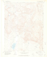
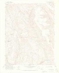
1973 Map of Cimarrona Peak
USGS Topo · Published 1975About this map
Cimarrona Peak stands as a prominent landmark in this high-altitude survey, which straddles the boundary between Hinsdale Co and Mineral Co. The map records a landscape dominated by the Continental Divide, which separates the headwaters of the Rio Grande National Forest from the San Juan National Forest. At the southern end, the Williams Creek Reservoir serves as a focal point for recreation, supported by the nearby Teal Campground and Cimarrona Campground.
Find a feature on this map
30 named features on this map. Tap any name to fly to it.
Don’t see what you’re looking for? This feature index may not catch every label — zoom into the map to look around manually.
Map Details
Editions of this 1973 Cimarrona Peak Map
4 editions found
Other maps of this area

1905 · San Cristobal
USGS Topo · 1:125,000

1907 · San Cristobal
USGS Topo · 1:125,000

1924 · Pagosa Springs
USGS Topo · 1:125,000

1927 · Pagosa Springs
USGS Topo · 1:125,000

1945 · Durango
USGS Topo · 1:250,000

1953 · Durango
USGS Topo · 1:250,000

1954 · Durango
USGS Topo · 1:250,000

1961 · Durango
USGS Topo · 1:250,000

1963 · Durango
USGS Topo · 1:250,000
1964 · Bear Mountain
USGS Topo · 1:24,000