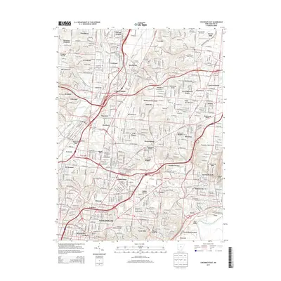
2013 Map of Cincinnati East
USGS Topo · Published 2013About this map
Mill Creek and its western fork carve through this industrial and residential corridor north of Cincinnati, as shown in this 2013 survey. The landscape is defined by a dense network of suburban municipalities and historical townships including Reading, Wyoming, and Lockland. This area serves as a significant educational and spiritual hub, home to institutions like Xavier Univ and Univ of Cincinnati-Raymond Walters Coll, alongside numerous commemorative sites such as Reading Lockland Cem and Rest Haven Memorial Park. The infrastructure is dominated by the heavy north-south arteries of I-75 and I-71, which intersect the patchwork of neighborhoods from Blue Ash down toward the Little Miami River. The map highlights the transition from commercial centers to residential enclaves like Amberley and Golf Manor, providing a detailed look at the modern layout of eastern Hamilton County.
Find a feature on this map
86 named features on this map. Tap any name to fly to it.
Don’t see what you’re looking for? This feature index may not catch every label — zoom into the map to look around manually.
Map Details
Editions of this 2013 Cincinnati East Map
This is the sole edition of this map. No revisions or reprints were ever made.
Other maps of this area

1898 · East Cincinnati
USGS Topo · 1:62,500

1904 · Mason
USGS Topo · 1:62,500

1906 · Mason
USGS Topo · 1:62,500

1914 · East Cincinnati
USGS Topo · 1:62,500

1914 · West Cincinnati
USGS Topo · 1:62,500

1915 · Hamilton
USGS Topo · 1:62,500

1917 · Hamilton
USGS Topo · 1:62,500

1950 · Covington
USGS Topo · 1:24,000

1952 · Newport
USGS Topo · 1:24,000

1953 · Withamsville
USGS Topo · 1:24,000