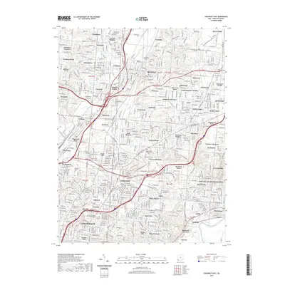
2019 Map of Cincinnati East
USGS Topo · Published 2019About this map
Mill Creek and the West Fork Mill Creek carve through the industrial and residential corridors of this 2019 survey, defining the geography between Wyoming, Lockland, and Reading. The map documents a densely developed urban landscape characterized by established neighborhoods like Bond Hill, Roselawn, and Amberley. Significant institutional footprints are visible, notably the campus of Xavier University and numerous large-scale memorial grounds such as Saints Peter and Paul Cem and Rest Haven Memorial Park.
Find a feature on this map
88 named features on this map. Tap any name to fly to it.
Don’t see what you’re looking for? This feature index may not catch every label — zoom into the map to look around manually.
Map Details
Editions of this 2019 Cincinnati East Map
This is the sole edition of this map. No revisions or reprints were ever made.
Other maps of this area

1898 · East Cincinnati
USGS Topo · 1:62,500

1904 · Mason
USGS Topo · 1:62,500

1906 · Mason
USGS Topo · 1:62,500

1914 · East Cincinnati
USGS Topo · 1:62,500

1914 · West Cincinnati
USGS Topo · 1:62,500

1915 · Hamilton
USGS Topo · 1:62,500

1917 · Hamilton
USGS Topo · 1:62,500

1950 · Covington
USGS Topo · 1:24,000

1952 · Newport
USGS Topo · 1:24,000

1953 · Withamsville
USGS Topo · 1:24,000