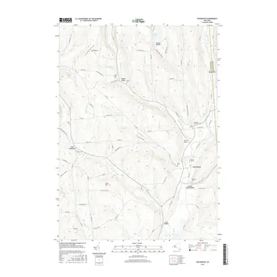
2016 Map of Cincinnatus
USGS Topo · Published 2016About this map
The Otselic River valley serves as the primary corridor for settlement and transit through this portion of Central New York, anchoring the communities of Cincinnatus and Lower Cincinnatus. The terrain is defined by significant elevation changes, with Mt Roderick and Dutch Hill overlooking a network of tributary streams including Gee Brook and Mead Brook. This 2016 survey documents the enduring rural character of the region, where numerous family and community burial grounds like the Holland Cem, Loope Cem, and Holmes Cem are distributed across the hillsides, providing valuable touchstones for local genealogical research. Outdoor recreation and conservation are represented by the presence of the N Country National Scenic Trail, which traverses the northwestern uplands near Mt Roderick. The map clearly delineates the Cortland Co and Chenango Co line as it follows the eastern edge of the river valley near Hydeville.
Find a feature on this map
80 named features on this map. Tap any name to fly to it.
Don’t see what you’re looking for? This feature index may not catch every label — zoom into the map to look around manually.
Map Details
Editions of this 2016 Cincinnatus Map
This is the sole edition of this map. No revisions or reprints were ever made.
Other maps of this area

1903 · Cortland
USGS Topo · 1:62,500

1903 · Harford
USGS Topo · 1:62,500

1904 · Greene
USGS Topo · 1:62,500

1904 · Pitcher
USGS Topo · 1:62,500

1906 · Catatonk
USGS Topo · 1:125,000

1943 · South Ostelic
USGS Topo · 1:24,000

1943 · Cincinnatus
USGS Topo · 1:24,000

1943 · Cuyler
USGS Topo · 1:24,000

1943 · Pitcher
USGS Topo · 1:24,000
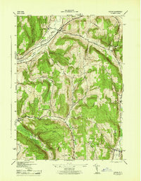
1944 · Cuyler
USGS Topo · 1:31,680