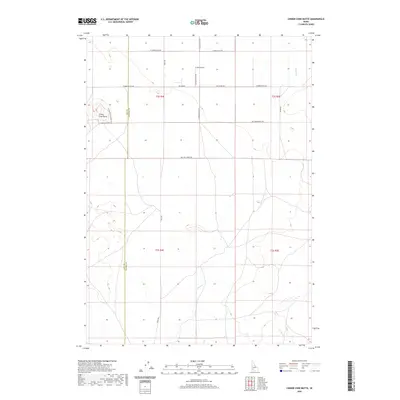
2020 Map of Cinder Cone Butte
USGS Topo · Published 2020About this map
Cinder Cone Butte stands as the primary topographical landmark in this high desert landscape along the border of Ada and Elmore counties. This portion of the Snake River Plain is defined by its volcanic geology and a sparse network of section-line roads, such as Simco Rd and Nw Harper Rd, which cut through the open rangeland. The drainage patterns of Squaw Cr and Canyon Cr emphasize the arid nature of the terrain, where water is a critical but infrequent presence. Evidence of light aviation or rural infrastructure is noted at the P and R Field, situated north of the butte. The map captures a contemporary look at land management in southwestern Idaho, where large-scale township and range divisions like t2s r4e and t3s r5e govern the distribution of this sparsely populated desert expanse.
Find a feature on this map
19 named features on this map. Tap any name to fly to it.
Don’t see what you’re looking for? This feature index may not catch every label — zoom into the map to look around manually.
Map Details
Editions of this 2020 Cinder Cone Butte Map
This is the sole edition of this map. No revisions or reprints were ever made.
Other maps of this area

1892 · Mountain Home
USGS Topo · 1:125,000

1892 · Bisuka
USGS Topo · 1:125,000

1893 · Mountain Home
USGS Topo · 1:125,000

1894 · Bisuka
USGS Topo · 1:125,000

1947 · Dorsey Butte
USGS Topo · 1:24,000

1948 · Dorsey Butte
USGS Topo · 1:24,000

1948 · Big Foot Butte
USGS Topo · 1:62,500

1948 · Little Joe Butte
USGS Topo · 1:24,000

1949 · Little Joe Butte
USGS Topo · 1:24,000

1955 · Orchard
USGS Topo · 1:24,000