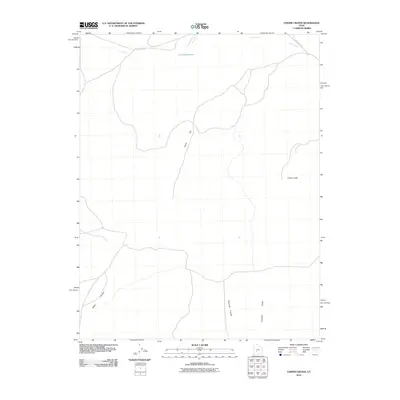
2010 Map of Cinder Crater
USGS Topo · Published 2010About this map
Cinder Crater dominates the eastern landscape of this Millard County interior, marking a volcanic legacy within the Great Basin. This 2010 survey by the U.S. Geological Survey illustrates a sparsely populated arid basin where seasonal water management is critical to the local land use, as evidenced by the presence of Danish Reservoir in the northern reach. The terrain transitions from the broad expanses of Horse Flat toward the defined elevations of Fourmile Ridge, providing a clear record of the area's geological and hydrological patterns.
Find a feature on this map
8 named features on this map. Tap any name to fly to it.
Don’t see what you’re looking for? This feature index may not catch every label — zoom into the map to look around manually.
Map Details
Editions of this 2010 Cinder Crater Map
This is the sole edition of this map. No revisions or reprints were ever made.
Other maps of this area

1885 · Beaver
USGS Topo · 1:250,000

1953 · Richfield
USGS Topo · 1:250,000

1954 · Beaver NE
USGS Topo · 1:24,000

1958 · Richfield
USGS Topo · 1:250,000

1958 · Beaver
USGS Topo · 1:62,500

1958 · Adamsville
USGS Topo · 1:62,500

1962 · Cove Fort
USGS Topo · 1:62,500

1973 · Pinnacle Pass
USGS Topo · 1:24,000

1973 · Antelope Spring
USGS Topo · 1:24,000
1980 · Beaver
USGS Topo · 1:100,000