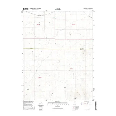
2014 Map of Cinder Crater
USGS Topo · Published 2014About this map
Cinder Crater stands as the primary topographic landmark in this high-desert region of the Great Basin, situated along the border of Millard and Beaver counties. The landscape is defined by its drainage systems and water management, featuring Cove Cr and the Danish Reservoir in the northern reaches, while the south is marked by Fourmile Canyon and the prominent Fourmile Ridge.
Find a feature on this map
15 named features on this map. Tap any name to fly to it.
Don’t see what you’re looking for? This feature index may not catch every label — zoom into the map to look around manually.
Map Details
Editions of this 2014 Cinder Crater Map
This is the sole edition of this map. No revisions or reprints were ever made.
Other maps of this area

1885 · Beaver
USGS Topo · 1:250,000

1953 · Richfield
USGS Topo · 1:250,000

1954 · Beaver NE
USGS Topo · 1:24,000

1958 · Richfield
USGS Topo · 1:250,000

1958 · Beaver
USGS Topo · 1:62,500

1958 · Adamsville
USGS Topo · 1:62,500

1962 · Cove Fort
USGS Topo · 1:62,500

1973 · Pinnacle Pass
USGS Topo · 1:24,000

1973 · Antelope Spring
USGS Topo · 1:24,000
1980 · Beaver
USGS Topo · 1:100,000