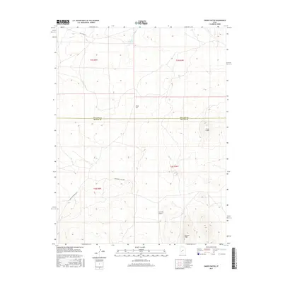
2017 Map of Cinder Crater
USGS Topo · Published 2017About this map
Cinder Crater dominates the eastern portion of this high-desert landscape along the border of Millard and Beaver counties. This 2017 survey details a remote volcanic and alluvial environment where water management is critical, evidenced by the Danish Reservoir catching flow from Cove Cr in the north. The terrain is defined by broad openings like Horse Flat and the dramatic rise of Fourmile Ridge in the southeast. Transportation through this arid basin relies on established routes such as Black Rock Rd and the Cunningham to Pine Creek road, which navigate the complex topography of Fourmile Canyon. The map provides a clear record of land division and topographical relief in a region where geological features like the central crater serve as primary landmarks.
Find a feature on this map
13 named features on this map. Tap any name to fly to it.
Don’t see what you’re looking for? This feature index may not catch every label — zoom into the map to look around manually.
Map Details
Editions of this 2017 Cinder Crater Map
This is the sole edition of this map. No revisions or reprints were ever made.
Other maps of this area

1885 · Beaver
USGS Topo · 1:250,000

1953 · Richfield
USGS Topo · 1:250,000

1954 · Beaver NE
USGS Topo · 1:24,000

1958 · Richfield
USGS Topo · 1:250,000

1958 · Beaver
USGS Topo · 1:62,500

1958 · Adamsville
USGS Topo · 1:62,500

1962 · Cove Fort
USGS Topo · 1:62,500

1973 · Pinnacle Pass
USGS Topo · 1:24,000

1973 · Antelope Spring
USGS Topo · 1:24,000
1980 · Beaver
USGS Topo · 1:100,000