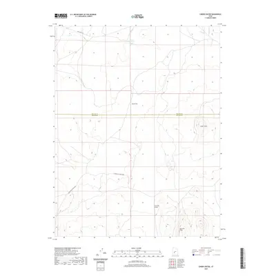
2020 Map of Cinder Crater
USGS Topo · Published 2020About this map
Cinder Crater stands as a prominent volcanic landmark in this high-desert portion of the eastern Great Basin. This 2020 survey documents a transition in the landscape along the county line between Millard and Beaver counties. The map highlights water management in an arid climate, specifically the Danish Reservoir and the drainage of Cove Cr in the northern reaches of the quadrangle. Transportation is defined by high-clearance routes and historic tracks such as Black Rock Rd and Cunningham To Pine Creek. To the south, the terrain becomes increasingly complex around Fourmile Canyon and the elevated Fourmile Ridge, while Horse Flat provides a rare expanse of level ground amidst the volcanic and alluvial features typical of this part of southern Utah.
Find a feature on this map
9 named features on this map. Tap any name to fly to it.
Don’t see what you’re looking for? This feature index may not catch every label — zoom into the map to look around manually.
Map Details
Editions of this 2020 Cinder Crater Map
This is the sole edition of this map. No revisions or reprints were ever made.
Other maps of this area

1885 · Beaver
USGS Topo · 1:250,000

1953 · Richfield
USGS Topo · 1:250,000

1954 · Beaver NE
USGS Topo · 1:24,000

1958 · Richfield
USGS Topo · 1:250,000

1958 · Beaver
USGS Topo · 1:62,500

1958 · Adamsville
USGS Topo · 1:62,500

1962 · Cove Fort
USGS Topo · 1:62,500

1973 · Pinnacle Pass
USGS Topo · 1:24,000

1973 · Antelope Spring
USGS Topo · 1:24,000
1980 · Beaver
USGS Topo · 1:100,000