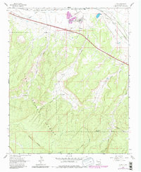
1962 Map of Ciniza
USGS Topo · Published 1981About this map
The Ciniza Refinery and its associated industrial infrastructure define the northern corridor of this McKinley County landscape, where the Atchison Topeka and Santa Fe railroad runs parallel to the historic path of U S 66 and the modern Interstate 40. This transportation and industrial hub sits just north of the expansive Cibola National Forest, a region marked by high-elevation landforms like Barometer Mountain and McKenzie Ridge.
Find a feature on this map
31 named features on this map. Tap any name to fly to it.
Don’t see what you’re looking for? This feature index may not catch every label — zoom into the map to look around manually.
Map Details
Editions of this 1962 Ciniza Map
Other maps of this area

1886 · Wingate
USGS Topo · 1:250,000

1892 · Wingate
USGS Topo · 1:250,000

1954 · Gallup
USGS Topo · 1:250,000

1958 · Gallup
USGS Topo · 1:250,000

1959 · Gallup
USGS Topo · 1:250,000

1961 · Cottonwood Canyon
USGS Topo · 1:24,000

1962 · Gallup
USGS Topo · 1:250,000

1962 · Ciniza
USGS Topo · 1:24,000

1962 · Continental Divide
USGS Topo · 1:24,000

1962 · Cottonwood Canyon
USGS Topo · 1:24,000