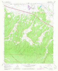
1962 Map of Ciniza
USGS Topo · Published 1981About this map
Industrial development along the Atchison Topeka and Santa Fe railroad corridor contrasts with the high terrain of the Cibola National Forest in this 1962 survey. The northern edge of the map is defined by the Puerco River and the transit lines of Route 66 and Interstate 40, supporting the Ciniza Refinery and the small settlement of Ciniza. These transport arteries parallel an Old Railroad Grade that speaks to earlier movements through the canyon country. Moving south, the landscape rises into the rugged peaks of Barometer Mountain and the high ridges of McKenzie Ridge. Water sources like Sixmile Spring, Whitewater Spring, and Natural Lake are critical markers in this arid environment, providing essential points for the B A Ranch and other local operations. Deep drainages such as Fourmile Canyon and Smith Canyon carve through the forested uplands, illustrating the complex geography of McKinley County.
Find a feature on this map
30 named features on this map. Tap any name to fly to it.
Don’t see what you’re looking for? This feature index may not catch every label — zoom into the map to look around manually.
Map Details
Editions of this 1962 Ciniza Map
Other maps of this area

1886 · Wingate
USGS Topo · 1:250,000

1892 · Wingate
USGS Topo · 1:250,000

1954 · Gallup
USGS Topo · 1:250,000

1958 · Gallup
USGS Topo · 1:250,000

1959 · Gallup
USGS Topo · 1:250,000

1961 · Cottonwood Canyon
USGS Topo · 1:24,000

1962 · Gallup
USGS Topo · 1:250,000

1962 · Ciniza
USGS Topo · 1:24,000

1962 · Continental Divide
USGS Topo · 1:24,000

1962 · Cottonwood Canyon
USGS Topo · 1:24,000