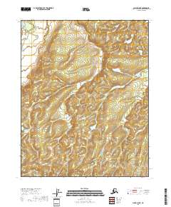
2018 Map of Circle D-5 NE
USGS Topo · Published 2018About this map
Beaver Creek winds through the northwestern corner of this interior Alaska landscape, providing the primary hydrological landmark in an area otherwise defined by high ridges and topographic relief. The map covers a transition of survey boundaries, including T14n R7e, T13n R8e, and T12n R8e. Unlike more developed regions, this terrain shows no roads or named settlements, reflecting the isolation of the Yukon-Koyukuk Census Area. The intricate contour lines illustrate a series of unnamed peaks and drainage basins that flow toward the larger river systems of the north. This document serves as a detailed record of the natural elevation and hydrological patterns in the subarctic wilderness before any significant human infrastructure reached these specific townships.
Find a feature on this map
7 named features on this map. Tap any name to fly to it.
Don’t see what you’re looking for? This feature index may not catch every label — zoom into the map to look around manually.
Map Details
Editions of this 2018 Circle D-5 NE Map
This is the sole edition of this map. No revisions or reprints were ever made.
Other maps of this area

1951 · Fort Yukon
USGS Topo · 1:250,000

1951 · Circle
USGS Topo · 1:250,000

1952 · Circle D-4
USGS Topo · 1:63,360

1952 · Circle D-5
USGS Topo · 1:63,360

1954 · Circle D-5
USGS Topo · 1:63,360

1955 · Circle
USGS Topo · 1:250,000

1956 · Fort Yukon A-4
USGS Topo · 1:63,360

1956 · Fort Yukon A-5
USGS Topo · 1:63,360

1956 · Fort Yukon
USGS Topo · 1:250,000

1964 · Circle
USGS Topo · 1:250,000