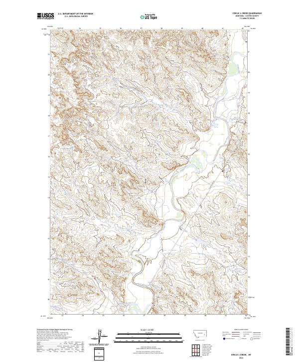
2024 Map of Circle L Creek
USGS Topo · Published 2024About this map
The Tongue River meanders through the eastern portion of this Custer County landscape, defining the local drainage and topography. This contemporary data shows a high-relief terrain of ridges and draws shaped by a series of significant tributaries, including Circle L Creek, Wolf Creek, and Thorpe Creek. The presence of the Tongue River Rd following the river valley suggests the primary corridor for movement and land access in this rural area. Farther south, the map details the courses of Kennedy Creek and Plunket Creek, providing a clear view of how the various drainages converge toward the main river channel. For those studying the hydrology and geographic structure of eastern Montana, the map offers precise naming of these smaller waterways such as Nelson Creek and Dry Creek, which might be overlooked on larger-scale surveys.
Find a feature on this map
16 named features on this map. Tap any name to fly to it.
Don’t see what you’re looking for? This feature index may not catch every label — zoom into the map to look around manually.
Map Details
Editions of this 2024 Circle L Creek Map
This is the sole edition of this map. No revisions or reprints were ever made.
Other maps of this area

1953 · Miles City
USGS Topo · 1:250,000

1957 · Miles City
USGS Topo · 1:250,000

1958 · Miles City
USGS Topo · 1:250,000

1968 · Lignite Creek
USGS Topo · 1:24,000

1968 · Paddy Fay Creek
USGS Topo · 1:24,000
1969 · Jack Creek NW
USGS Topo · 1:24,000

1969 · Horse Creek
USGS Topo · 1:24,000

1969 · Circle L Creek
USGS Topo · 1:24,000

1969 · Beebe SW
USGS Topo · 1:24,000
1969 · Whitney Creek
USGS Topo · 1:24,000