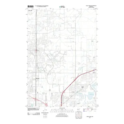
2010 Map of Circle Pines
USGS Topo · Published 2010About this map
Anoka County Airport and a network of smaller landing strips like Vieira Airport and Lino Air Park anchor this portion of the northern Twin Cities suburbs. The landscape is a mix of established residential patterns and conservation areas, with Blaine and Circle Pines serving as primary centers. Local community life is anchored by landmarks such as the Saint Joseph Catholic Church and its accompanying Saint Joseph Catholic Church Cemetery near Lexington. The hydrology is defined by the winding course of Coon Creek and Rice Creek, alongside numerous glacial water bodies including Lochness Lake, Golden Lake, and Baldwin Lake. This survey illustrates the suburban expansion of the early 21st century, where recreational spaces like Kate Haven Golf Course and The First Tee sit alongside essential civic hubs like the Blaine Post Office.
Find a feature on this map
39 named features on this map. Tap any name to fly to it.
Don’t see what you’re looking for? This feature index may not catch every label — zoom into the map to look around manually.
Map Details
Editions of this 2010 Circle Pines Map
This is the sole edition of this map. No revisions or reprints were ever made.
Other maps of this area

1902 · White Bear
USGS Topo · 1:62,500

1902 · Anoka
USGS Topo · 1:62,500

1916 · St. Francis
USGS Topo · 1:62,500

1919 · St. Francis
USGS Topo · 1:62,500

1952 · Centerville
USGS Topo · 1:24,000

1952 · White Bear Lake West
USGS Topo · 1:24,000

1952 · Minneapolis North
USGS Topo · 1:24,000

1952 · New Brighton
USGS Topo · 1:24,000

1953 · Stillwater
USGS Topo · 1:250,000

1955 · Circle Pines
USGS Topo · 1:24,000