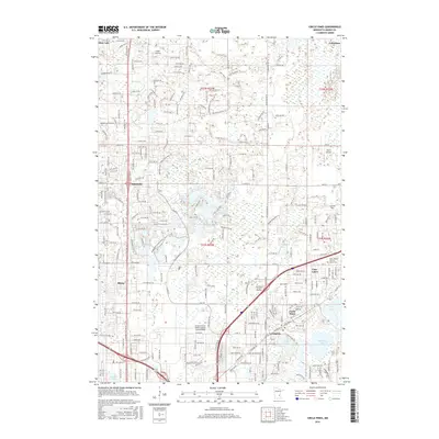
2016 Map of Circle Pines
USGS Topo · Published 2016About this map
Blaine and its surrounding Anoka County suburbs appear here in a state of late-twentieth-century residential and commercial density, woven through with numerous small lakes and drainage networks. The landscape is defined by its transition from the more established corridors of Johnsville and Lexington to the expansive wetlands and recreation areas that characterize the region. Notable infrastructure includes the Anoka County-Blaine Airport (Janes Field) and the Minnesota Sch of Business, reflecting the area's development as a regional hub. Water remains a central feature, with Coon Cr winding through the northern reaches while larger basins like Baldwin Lake and Rice Lake sit to the southeast. Local history is anchored by sites such as the Saint Joseph Catholic Church Cem, providing a genealogical touchpoint amidst the modern grid of residential streets and arterial roads like Main St and Bunker Lake Blvd NE.
Find a feature on this map
111 named features on this map. Tap any name to fly to it.
Don’t see what you’re looking for? This feature index may not catch every label — zoom into the map to look around manually.
Map Details
Editions of this 2016 Circle Pines Map
This is the sole edition of this map. No revisions or reprints were ever made.
Other maps of this area

1902 · White Bear
USGS Topo · 1:62,500

1902 · Anoka
USGS Topo · 1:62,500

1916 · St. Francis
USGS Topo · 1:62,500

1919 · St. Francis
USGS Topo · 1:62,500

1952 · Centerville
USGS Topo · 1:24,000

1952 · White Bear Lake West
USGS Topo · 1:24,000

1952 · Minneapolis North
USGS Topo · 1:24,000

1952 · New Brighton
USGS Topo · 1:24,000

1953 · Stillwater
USGS Topo · 1:250,000

1955 · Circle Pines
USGS Topo · 1:24,000