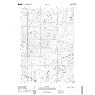
2019 Map of Circle Pines
USGS Topo · Published 2019About this map
Blaine and Ham Lake form the core of this suburban landscape in Anoka County, where modern residential development increasingly borders established local landmarks. The map shows a region defined by its aviation history and complex hydrology, featuring the Anoka County-Blaine Airport (Janes Field) and the smaller Lino Air Park to the east. The southern portion of the sheet is densely patterned with the street grids of Lexington and Circle Pines, situated near a chain of water bodies including Golden Lake and Baldwin Lake. Local heritage is visible at the Saint Joseph of the Lakes Catholic Church Cem near Lino Lakes. This survey captures the transition of formerly rural spaces like Johnsville and Cooks Landing into the expanding infrastructure of the Twin Cities' northern reaches.
Find a feature on this map
31 named features on this map. Tap any name to fly to it.
Don’t see what you’re looking for? This feature index may not catch every label — zoom into the map to look around manually.
Map Details
Editions of this 2019 Circle Pines Map
This is the sole edition of this map. No revisions or reprints were ever made.
Other maps of this area

1902 · White Bear
USGS Topo · 1:62,500

1902 · Anoka
USGS Topo · 1:62,500

1916 · St. Francis
USGS Topo · 1:62,500

1919 · St. Francis
USGS Topo · 1:62,500

1952 · Centerville
USGS Topo · 1:24,000

1952 · White Bear Lake West
USGS Topo · 1:24,000

1952 · Minneapolis North
USGS Topo · 1:24,000

1952 · New Brighton
USGS Topo · 1:24,000

1953 · Stillwater
USGS Topo · 1:250,000

1955 · Circle Pines
USGS Topo · 1:24,000