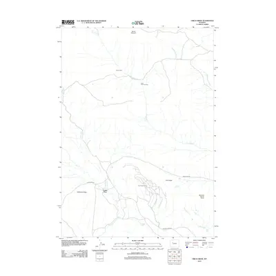
2012 Map of Circle Ridge
USGS Topo · Published 2012About this map
Circle Ridge Oil Field serves as the industrial centerpiece of this high-desert Wyoming landscape, where a complex network of roads and infrastructure indicates active petroleum extraction north of Fivemile Cr. The terrain is characterized by prominent geological formations such as Rattlesnake Ridge, Circle Ridge, and the Maverick Spring Dome, defining a region shaped more by resource development and seasonal ranching than permanent urban settlement. Remote outposts like Vincent Cabin and Porter Cabin Cow Camp speak to the area's history of livestock management and grazing, while named locations such as Collins Place mark the modest human footprint in this arid environment. Water resources are primarily seasonal, evidenced by the numerous intermittent drainages like Dry Muddy Cr and Little Dry Cr, which eventually reach Kanaugh Lake in the southern portion of the quadrangle.
Find a feature on this map
17 named features on this map. Tap any name to fly to it.
Don’t see what you’re looking for? This feature index may not catch every label — zoom into the map to look around manually.
Map Details
Editions of this 2012 Circle Ridge Map
This is the sole edition of this map. No revisions or reprints were ever made.
Other maps of this area

1904 · Kirwin
USGS Topo · 1:125,000

1906 · Kirwin
USGS Topo · 1:125,000

1951 · Maverick Spring
USGS Topo · 1:24,000

1952 · Antelope Ridge
USGS Topo · 1:24,000

1952 · Crowheart NW
USGS Topo · 1:24,000

1952 · Crowheart NE
USGS Topo · 1:24,000

1955 · Thermopolis
USGS Topo · 1:250,000

1957 · Crowheart NE
USGS Topo · 1:24,000

1958 · Thermopolis
USGS Topo · 1:250,000

1962 · Thermopolis
USGS Topo · 1:250,000