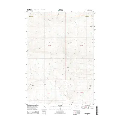
2015 Map of Circle Ridge
USGS Topo · Published 2015About this map
Collins Place and the Circle Ridge settlement occupy a high, arid landscape on the boundary between Hot Springs and Fremont Counties. This 2015 survey details a region defined by complex drainage patterns, where seasonal watercourses like Dry Muddy Creek and Little Dry Creek carve through the foothills of the Absaroka Range. The map reveals a land utilized for its geologic potential, highlighted by the prominent Maverick Spring Dome and the winding course of Circle Ridge Road providing access across the ridges. Small water features such as Kunaugh Lake and Red Spring are vital landmarks in this high-elevation terrain. From the summit of Spring Mountain to the depths of Sagwup Draw, the map provides a precise record of the physical geography and ranching-related settlements that characterize this portion of the Wyoming basins.
Find a feature on this map
25 named features on this map. Tap any name to fly to it.
Don’t see what you’re looking for? This feature index may not catch every label — zoom into the map to look around manually.
Map Details
Editions of this 2015 Circle Ridge Map
This is the sole edition of this map. No revisions or reprints were ever made.
Other maps of this area

1904 · Kirwin
USGS Topo · 1:125,000

1906 · Kirwin
USGS Topo · 1:125,000

1951 · Maverick Spring
USGS Topo · 1:24,000

1952 · Antelope Ridge
USGS Topo · 1:24,000

1952 · Crowheart NW
USGS Topo · 1:24,000

1952 · Crowheart NE
USGS Topo · 1:24,000

1955 · Thermopolis
USGS Topo · 1:250,000

1957 · Crowheart NE
USGS Topo · 1:24,000

1958 · Thermopolis
USGS Topo · 1:250,000

1962 · Thermopolis
USGS Topo · 1:250,000