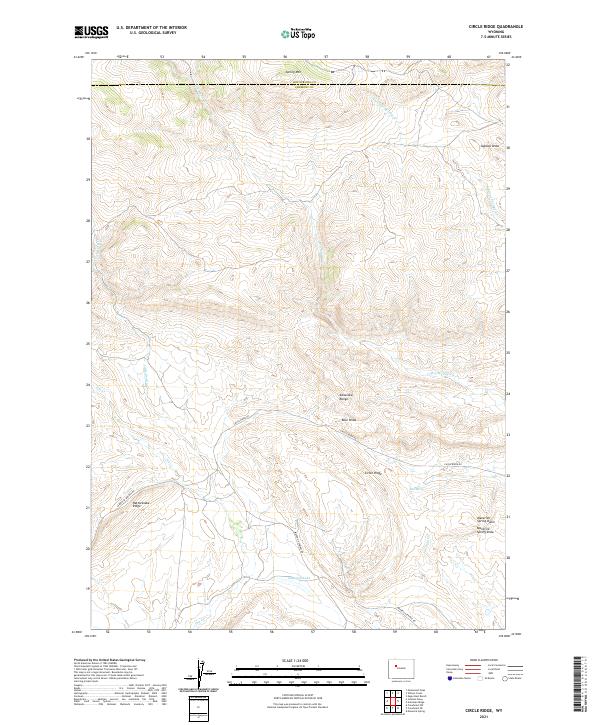
2021 Map of Circle Ridge
USGS Topo · Published 2021About this map
Circle Ridge is situated within the high-altitude landscape of the Absaroka Range, where the northern boundary of Fremont County meets Hot Springs County. The area is characterized by a complex network of seasonal drainages and topographic landmarks that suggest a history of resource extraction and ranching. To the southeast, Maverick Spring Dome and Maverick Spring Draw overlook a series of winding tracks, including Circle Ridge Rd and Maverick Springs Rd. These routes provide access through the high ridges, connecting points such as Rattlesnake Ridge and Spring Mtn. A few contained water sources like Kanaugh Lake and Red Spring offer rare permanent water in a terrain dominated by dry beds like Dry Muddy Cr and Fivemile Cr.
Find a feature on this map
24 named features on this map. Tap any name to fly to it.
Don’t see what you’re looking for? This feature index may not catch every label — zoom into the map to look around manually.
Map Details
Editions of this 2021 Circle Ridge Map
This is the sole edition of this map. No revisions or reprints were ever made.
Other maps of this area

1904 · Kirwin
USGS Topo · 1:125,000

1906 · Kirwin
USGS Topo · 1:125,000

1951 · Maverick Spring
USGS Topo · 1:24,000

1952 · Antelope Ridge
USGS Topo · 1:24,000

1952 · Crowheart NW
USGS Topo · 1:24,000

1952 · Crowheart NE
USGS Topo · 1:24,000

1955 · Thermopolis
USGS Topo · 1:250,000

1957 · Crowheart NE
USGS Topo · 1:24,000

1958 · Thermopolis
USGS Topo · 1:250,000

1962 · Thermopolis
USGS Topo · 1:250,000