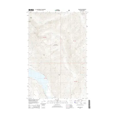
2014 Map of Circus Peak
USGS Topo · Published 2014About this map
Flathead National Forest land dominates this 2014 survey, which reveals the high-altitude drainage systems and vertical relief of the Flathead Range. The southwest corner is marked by the presence of the Hungry Horse Reservoir, fed by various mountain tributaries including Deadhorse Cr and Dry Park Cr. The topography is defined by a series of prominent summits like Circus Peak, Prospector Mtn, and Dry Park Mtn, which separate the various creek valleys. Limited vehicle access is shown along the reservoir shoreline via W Side Rd and E Side Rd, reflecting the remote and protected nature of this wilderness area. The map illustrates how the drainage patterns of Bergsicker Cr and Lower Twin Cr dictate the navigation of the landscape between these massive peaks.
Find a feature on this map
27 named features on this map. Tap any name to fly to it.
Don’t see what you’re looking for? This feature index may not catch every label — zoom into the map to look around manually.
Map Details
Editions of this 2014 Circus Peak Map
This is the sole edition of this map. No revisions or reprints were ever made.
Other maps of this area

1913 · Marias Pass
USGS Topo · 1:125,000

1914 · Nyack
USGS Topo · 1:125,000

1936 · Silvertip
USGS Topo · 1:96,000

1942 · Silvertip
USGS Topo · 1:125,000

1955 · Choteau
USGS Topo · 1:250,000

1957 · Choteau
USGS Topo · 1:250,000

1958 · Choteau
USGS Topo · 1:250,000

1958 · Circus Peak
USGS Topo · 1:24,000

1958 · Nimrod
USGS Topo · 1:24,000

1958 · Quintonkon
USGS Topo · 1:24,000