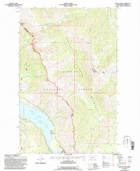
1994 Map of Circus Peak
USGS Topo · Published 1997About this map
Hungry Horse Reservoir dominates the southwestern portion of this landscape, fed by the South Fork Flathead River. The map illustrates the boundary between the Flathead National Forest and the Great Bear Wilderness, a region defined by high peaks and an intricate drainage system. The steep terrain rises from the reservoir level toward landmarks like Circus Peak and Prospect Mountain, with the Hungry Horse Spotted Bear Rd serving as the primary access corridor through the river valley.
Find a feature on this map
28 named features on this map. Tap any name to fly to it.
Don’t see what you’re looking for? This feature index may not catch every label — zoom into the map to look around manually.
Map Details
Editions of this 1994 Circus Peak Map
This is the sole edition of this map. No revisions or reprints were ever made.
Other maps of this area

1913 · Marias Pass
USGS Topo · 1:125,000

1914 · Nyack
USGS Topo · 1:125,000

1936 · Silvertip
USGS Topo · 1:96,000

1942 · Silvertip
USGS Topo · 1:125,000

1955 · Choteau
USGS Topo · 1:250,000

1957 · Choteau
USGS Topo · 1:250,000

1958 · Choteau
USGS Topo · 1:250,000

1958 · Circus Peak
USGS Topo · 1:24,000

1958 · Nimrod
USGS Topo · 1:24,000

1958 · Quintonkon
USGS Topo · 1:24,000