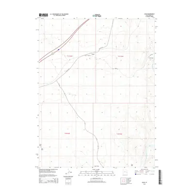
2014 Map of Cisco
USGS Topo · Published 2014About this map
Cisco serves as the central hub of this eastern Utah desert landscape, where the historical corridor of the Old Cisco Hwy intersects with the modern path of Ut-128. The terrain is defined by a network of seasonal drainages, including Danish Wash, Sagers Wash, and Nash Wash, all contributing to the larger watershed of the Colorado River as it curves through the southeast corner of the map. Infrastructure critical to the arid environment is noted at the Cisco Pumphouse and several other utility stations. These markers suggest a history of resource management and transportation adaptation in a region where water sources like Hogan Spring were vital waypoints for travelers moving across the high desert between the river and the highway corridor.
Find a feature on this map
15 named features on this map. Tap any name to fly to it.
Don’t see what you’re looking for? This feature index may not catch every label — zoom into the map to look around manually.
Map Details
Editions of this 2014 Cisco Map
This is the sole edition of this map. No revisions or reprints were ever made.
Other maps of this area

1885 · East Tavaputs
USGS Topo · 1:250,000

1885 · La Sal
USGS Topo · 1:250,000

1954 · Westwater 4 SW
USGS Topo · 1:24,000

1954 · Mt. Waas 1 SW
USGS Topo · 1:24,000

1954 · Mt. Waas 1 NW
USGS Topo · 1:24,000

1954 · Coates Creek
USGS Topo · 1:62,500

1955 · Mt. Waas 2 SE
USGS Topo · 1:24,000

1956 · Moab
USGS Topo · 1:250,000

1956 · Grand Junction
USGS Topo · 1:250,000

1958 · Cisco
USGS Topo · 1:62,500