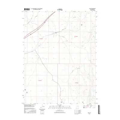
2017 Map of Cisco
USGS Topo · Published 2017About this map
The settlement of Cisco sits as a vital junction within the arid expanse of Grand Valley, defined by the crossing of major transportation routes and the essential proximity of water resources. This 2017 survey details a landscape where infrastructure is meticulously tied to the drainage patterns of Cisco Wash, Sagers Wash, and Nash Wash. The presence of the Cisco Pumphouse and the nearby Colorado River in the southeastern corner underscores the critical nature of water management in this high-desert environment.
Find a feature on this map
20 named features on this map. Tap any name to fly to it.
Don’t see what you’re looking for? This feature index may not catch every label — zoom into the map to look around manually.
Map Details
Editions of this 2017 Cisco Map
This is the sole edition of this map. No revisions or reprints were ever made.
Other maps of this area

1885 · East Tavaputs
USGS Topo · 1:250,000

1885 · La Sal
USGS Topo · 1:250,000

1954 · Westwater 4 SW
USGS Topo · 1:24,000

1954 · Mt. Waas 1 SW
USGS Topo · 1:24,000

1954 · Mt. Waas 1 NW
USGS Topo · 1:24,000

1954 · Coates Creek
USGS Topo · 1:62,500

1955 · Mt. Waas 2 SE
USGS Topo · 1:24,000

1956 · Moab
USGS Topo · 1:250,000

1956 · Grand Junction
USGS Topo · 1:250,000

1958 · Cisco
USGS Topo · 1:62,500