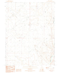
1991 Map of Cisco
USGS Topo · Published 1991About this map
Cisco sits as a lonely rail-side outpost in the high desert of Grand County, defined by its position along an Old Railroad Grade and its proximity to the Colorado River. This landscape is marked by the infrastructure of energy extraction, dominated by an extensive Gas and Oil Field and a network of pipelines that traverse the arid terrain. The presence of a Landing Strip and multiple Drill Holes indicates a history of active industrial survey and logistical operations in this isolated corner of Utah.
Find a feature on this map
22 named features on this map. Tap any name to fly to it.
Don’t see what you’re looking for? This feature index may not catch every label — zoom into the map to look around manually.
Map Details
Editions of this 1991 Cisco Map
This is the sole edition of this map. No revisions or reprints were ever made.
Other maps of this area

1885 · East Tavaputs
USGS Topo · 1:250,000

1885 · La Sal
USGS Topo · 1:250,000

1954 · Westwater 4 SW
USGS Topo · 1:24,000

1954 · Mt. Waas 1 SW
USGS Topo · 1:24,000

1954 · Mt. Waas 1 NW
USGS Topo · 1:24,000

1954 · Coates Creek
USGS Topo · 1:62,500

1955 · Mt. Waas 2 SE
USGS Topo · 1:24,000

1956 · Moab
USGS Topo · 1:250,000

1956 · Grand Junction
USGS Topo · 1:250,000

1958 · Cisco
USGS Topo · 1:62,500