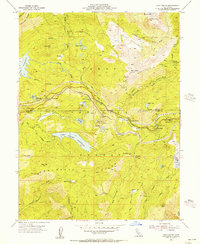
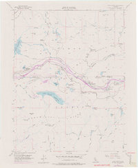
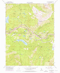
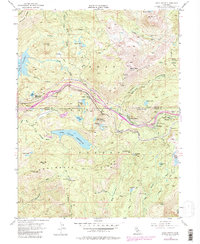
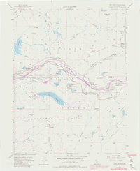
1955 Map of Cisco Grove
USGS Topo · Published 1956This historical map portrays the area of Cisco Grove in 1955, primarily covering Nevada County as well as portions of Placer County. Featuring a scale of 1:24000, this map provides a highly detailed snapshot of the terrain, roads, buildings, counties, and historical landmarks in the Cisco Grove region at the time. Published in 1956, it is one of 9 known editions of this map due to revisions or reprints.
Find a feature on this map
55 named features on this map. Tap any name to fly to it.
Don’t see what you’re looking for? This feature index may not catch every label — zoom into the map to look around manually.
Map Details
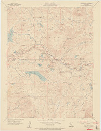
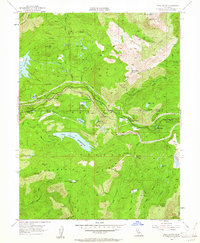
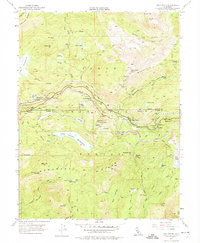
Editions of this 1955 Cisco Grove Map
9 editions found
Historical Maps of Big Bend Through Time
34 maps found

1949 Chicago Park
Nevada County, CA

1949 Lake Combie
Nevada County, CA

1949 North Bloomfield
Nevada County, CA

1949 Rough And Ready
Nevada County, CA

1949 Wolf
Nevada County, CA

1950 Lake Combie
Nevada County, CA

1950 Rough And Ready
Nevada County, CA

1950 Wolf
Nevada County, CA

1951 Chicago Park
Nevada County, CA

1951 North Bloomfield
Nevada County, CA

1955 Blue Canyon
Nevada County, CA

1955 Boca
Nevada County, CA

1955 Cisco Grove
Nevada County, CA

1955 Donner Pass
Nevada County, CA

1955 Emigrant Gap
Nevada County, CA

1981 Hobart Mills
Nevada County, CA

1981 Independence Lake
Nevada County, CA

1981 Webber Peak
Nevada County, CA

1983 English Mtn
Nevada County, CA

1995 Lake Combie
Nevada County, CA

1995 Rough And Ready
Nevada County, CA

1995 Wolf
Nevada County, CA

1998 Lake Combie
Nevada County, CA

1998 Rough And Ready
Nevada County, CA

1998 Wolf
Nevada County, CA

2000 Blue Canyon
Nevada County, CA

2000 Boca
Nevada County, CA

2000 Chicago Park
Nevada County, CA

2000 Cisco Grove
Nevada County, CA

2000 English Mountain
Nevada County, CA

2000 Hobart Mills
Nevada County, CA

2000 Independence Lake
Nevada County, CA

2000 North Bloomfield
Nevada County, CA

2000 Webber Peak
Nevada County, CA