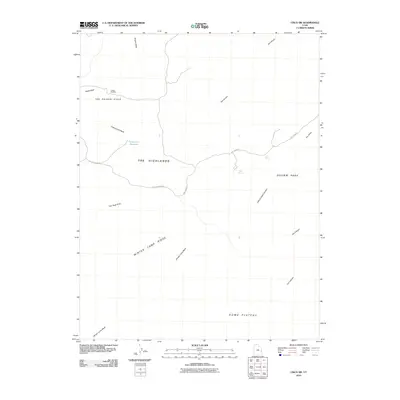
2010 Map of Cisco SW
USGS Topo · Published 2010About this map
The Cactus Rat Mine stands as a distinct industrial mark on this arid landscape, located near the evocative boundary of The Poison Strip. This high desert terrain is defined by a network of ephemeral watercourses and vital desert water sources, including Yellow Cat Reservoir, Caves Spring, and Auger Spring. The map documents a complex topography of mesas and drainages, moving from Dome Plateau in the south up through Winter Camp Ridge and across the broad expanse of The Highlands.
Find a feature on this map
21 named features on this map. Tap any name to fly to it.
Don’t see what you’re looking for? This feature index may not catch every label — zoom into the map to look around manually.
Map Details
Editions of this 2010 Cisco SW Map
This is the sole edition of this map. No revisions or reprints were ever made.
Other maps of this area

1885 · La Sal
USGS Topo · 1:250,000

1954 · Mt. Waas 3 NE
USGS Topo · 1:24,000

1954 · Mt. Waas 3 NW
USGS Topo · 1:24,000

1954 · Castle Valley
USGS Topo · 1:62,500

1955 · Mt. Waas 2 SE
USGS Topo · 1:24,000

1956 · Moab
USGS Topo · 1:250,000

1958 · Thompson
USGS Topo · 1:62,500

1958 · Cisco
USGS Topo · 1:62,500

1959 · Moab
USGS Topo · 1:250,000
1959 · Moab
USGS Topo · 1:62,500