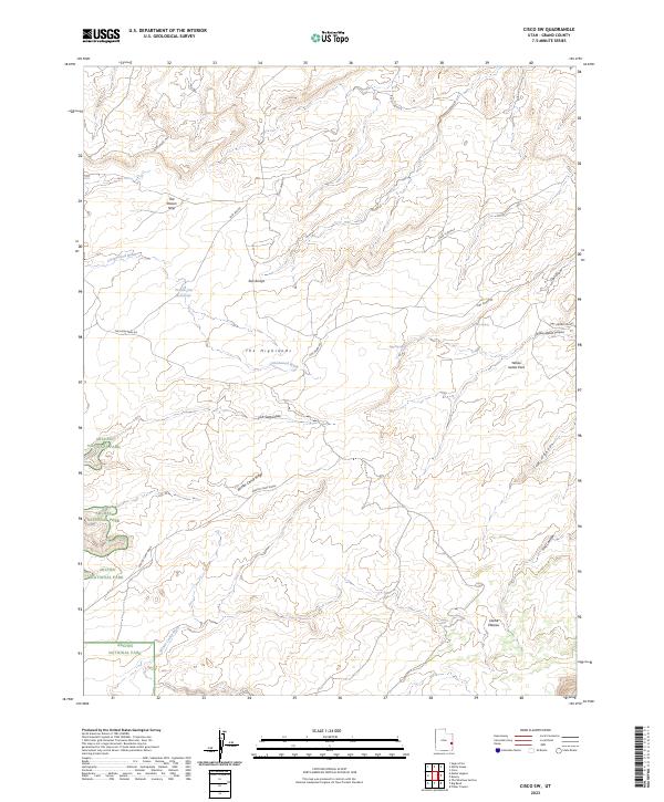
2023 Map of Cisco SW
USGS Topo · Published 2023About this map
Arches National Park bounds the western edge of this landscape, where the high desert terrain of Grand County is defined by complex drainage systems and unique geological formations. The area transitions from the Monument Hills and Cisco Clayhills in the north toward the expansive The Highlands and the prominent Dome Plateau in the south. This region is characterized by a network of seasonal watercourses like Cottonwood Wash and Fish Seep Draw, supporting isolated resources such as the Yellow Cat Reservoir. Human presence is marked by the small settlement at San Arroyo and a system of primitive routes including The Highlands Rd and Owl Draw Rd, which provide access through the distinctively named The Poison Strip and into the deep recesses of Yellow Jacket Canyon.
Find a feature on this map
23 named features on this map. Tap any name to fly to it.
Don’t see what you’re looking for? This feature index may not catch every label — zoom into the map to look around manually.
Map Details
Editions of this 2023 Cisco SW Map
This is the sole edition of this map. No revisions or reprints were ever made.
Other maps of this area

1885 · La Sal
USGS Topo · 1:250,000

1954 · Mt. Waas 3 NE
USGS Topo · 1:24,000

1954 · Mt. Waas 3 NW
USGS Topo · 1:24,000

1954 · Castle Valley
USGS Topo · 1:62,500

1955 · Mt. Waas 2 SE
USGS Topo · 1:24,000

1956 · Moab
USGS Topo · 1:250,000

1958 · Thompson
USGS Topo · 1:62,500

1958 · Cisco
USGS Topo · 1:62,500

1959 · Moab
USGS Topo · 1:250,000
1959 · Moab
USGS Topo · 1:62,500