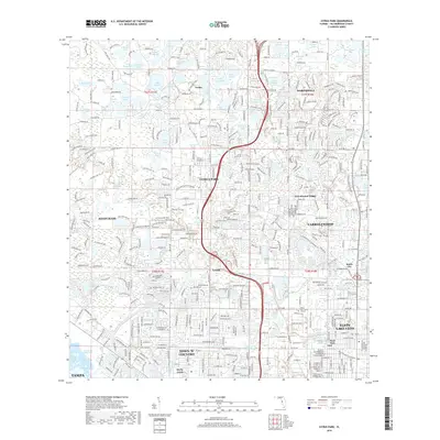
2018 Map of Citrus Park
USGS Topo · Published 2018About this map
Citrus Park and the surrounding Hillsborough County suburbs appear as a dense network of residential subdivisions and pocketed wetlands in this modern survey. The landscape is defined by its numerous small lakes, including Lake Josephine, Lake Rogers, and Lake Armistead, which are woven into the fabric of growing communities like Westchase and Northdale. The map captures the intensive development of the Tampa periphery, where historical settlements like Cosme and Tarpon have been integrated into the suburban sprawl. The layout reveals how modern planning has managed the local hydrology, with roads such as Co Rd 587 and Tobacco Rd navigating around significant water bodies. Educational and civic growth is marked by the Keiser Univ Tampa Campus, while the transition toward the city is evident in the southern reaches of Town 'N' Country and Egypt Lake-Leto.
Find a feature on this map
424 named features on this map. Tap any name to fly to it.
Don’t see what you’re looking for? This feature index may not catch every label — zoom into the map to look around manually.
Map Details
Editions of this 2018 Citrus Park Map
This is the sole edition of this map. No revisions or reprints were ever made.
Other maps of this area

1921 · Tampa
USGS Topo · 1:62,500

1921 · St Petersburg
USGS Topo · 1:62,500

1943 · Gandy Bridge
USGS Topo · 1:31,680

1943 · Safety Harbor
USGS Topo · 1:31,680

1943 · Odessa
USGS Topo · 1:24,000

1943 · Elfers
USGS Topo · 1:24,000

1943 · Lutz
USGS Topo · 1:24,000

1943 · Oldsmar
USGS Topo · 1:24,000

1944 · Sulphur Springs
USGS Topo · 1:31,680

1944 · Tampa
USGS Topo · 1:31,680