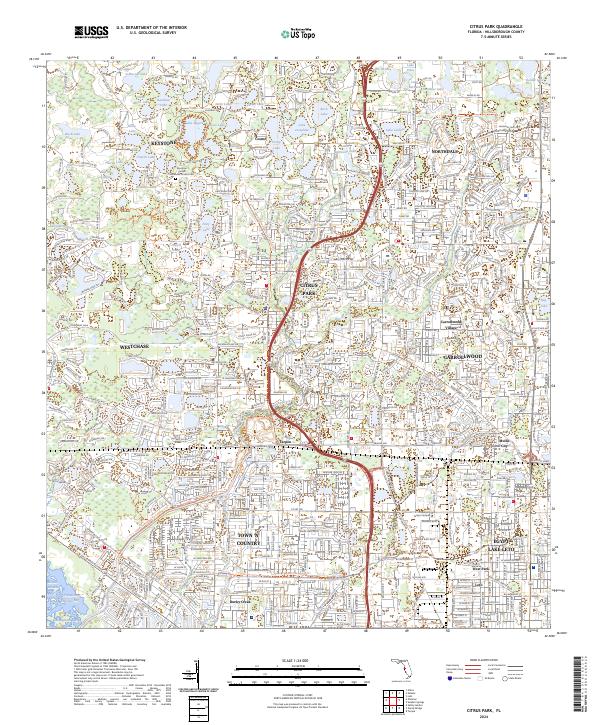
2024 Map of Citrus Park
USGS Topo · Published 2024About this map
Citrus Park and the surrounding northwest Hillsborough County suburbs are defined by an intricate network of lakes and modern residential growth. This 2024 map illustrates the dense suburban landscape where developments like Westchase and Carrollwood Village sit alongside older nodes like Keystone and Cosme. The terrain is characterized by dozens of small water bodies, ranging from Lake Rogers and Lake Josephine in the north to the southern reaches of Rocky Creek as it approaches the bay.
Find a feature on this map
64 named features on this map. Tap any name to fly to it.
Don’t see what you’re looking for? This feature index may not catch every label — zoom into the map to look around manually.
Map Details
Editions of this 2024 Citrus Park Map
This is the sole edition of this map. No revisions or reprints were ever made.
Historical Maps of Eagle Creek Through Time
4 maps found