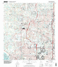
1998 Map of Citrus Park
USGS Topo · Published 2001About this map
Town 'n' Country and West Park dominate the southern half of this suburban landscape, showing the dense residential growth patterns of northwest Hillsborough County in the late 1990s. The area is defined by a complex network of residential subdivisions and commercial centers, punctuated by an extraordinary number of small bodies of water like Lake Leclare, Horse Lake, and Cypress Lake. These natural features are integrated into the modern community layout, which includes significant institutional landmarks such as Town and Country Hospital and Sickles High Sch.
Find a feature on this map
87 named features on this map. Tap any name to fly to it.
Don’t see what you’re looking for? This feature index may not catch every label — zoom into the map to look around manually.
Map Details
Editions of this 1998 Citrus Park Map
This is the sole edition of this map. No revisions or reprints were ever made.
Other maps of this area

1921 · Tampa
USGS Topo · 1:62,500

1921 · St Petersburg
USGS Topo · 1:62,500

1943 · Gandy Bridge
USGS Topo · 1:31,680

1943 · Safety Harbor
USGS Topo · 1:31,680

1943 · Odessa
USGS Topo · 1:24,000

1943 · Elfers
USGS Topo · 1:24,000

1943 · Lutz
USGS Topo · 1:24,000

1943 · Oldsmar
USGS Topo · 1:24,000

1944 · Sulphur Springs
USGS Topo · 1:31,680

1944 · Tampa
USGS Topo · 1:31,680