
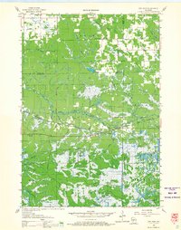
1957 Map of City Point
USGS Topo · Published 1960About this map
The East Fork Black River and the Green Bay and Western railroad corridor define the central geography of this central Wisconsin landscape during the late 1950s. The settlement at City Point serves as a local hub, supported by the Martyrs Cem and City Point Cem. To the north, the community of Sherwood is situated near the Sherwood Dam, while smaller locales like Pray and Spaulding mark the western rail line.
Find a feature on this map
40 named features on this map. Tap any name to fly to it.
Don’t see what you’re looking for? This feature index may not catch every label — zoom into the map to look around manually.
Map Details
Editions of this 1957 City Point Map
2 editions found
Other maps of this area

1947 · Millston
USGS Topo · 1:62,500

1949 · Millston
USGS Topo · 1:62,500

1953 · Neillsville
USGS Topo · 1:62,500

1953 · Eau Claire
USGS Topo · 1:250,000

1954 · Granton
USGS Topo · 1:62,500

1954 · Marshfield
USGS Topo · 1:62,500

1957 · Pittsville
USGS Topo · 1:48,000

1958 · Eau Claire
USGS Topo · 1:250,000

1958 · Hatfield
USGS Topo · 1:48,000

1958 · Necedah
USGS Topo · 1:48,000