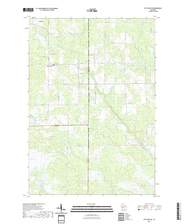
2022 Map of City Point NE
USGS Topo · Published 2022About this map
Sherwood sits at the intersection of River Rd and Co Rd Z, serving as a focal point in a landscape defined by the shifting boundaries of Clark, Wood, and Jackson counties. To the north lies Nevins, situated near the headwaters of the E Fork Black River. This 2022 survey illustrates a region where water management and drainage are central to the terrain, evidenced by the extensive wetland systems of Ammundson Marsh, Eyman Marsh, and the descriptively named Rattlesnake Marsh. Local genealogy is anchored at the Sherwood Cem, while the drainage network of Rocky Run, Hay Cr, and Lead Cr suggests a territory defined more by its natural hydrography than by dense urban development. The grid of rural routes like Ballard Rd and Steffek Rd provides access to these low-lying reaches where the East Fork Black River dominates the drainage basin.
Find a feature on this map
51 named features on this map. Tap any name to fly to it.
Don’t see what you’re looking for? This feature index may not catch every label — zoom into the map to look around manually.
Map Details
Editions of this 2022 City Point NE Map
This is the sole edition of this map. No revisions or reprints were ever made.
Other maps of this area

1953 · Eau Claire
USGS Topo · 1:250,000

1954 · Granton
USGS Topo · 1:62,500

1954 · Marshfield
USGS Topo · 1:62,500

1957 · Pittsville
USGS Topo · 1:48,000

1957 · City Point
USGS Topo · 1:48,000

1958 · Eau Claire
USGS Topo · 1:250,000

1964 · Eau Claire
USGS Topo · 1:250,000

1967 · Pittsville
USGS Topo · 1:62,500

1970 · City Point NE
USGS Topo · 1:24,000

1970 · Spaulding
USGS Topo · 1:24,000