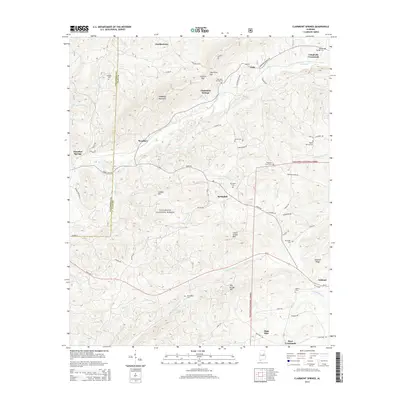
2014 Map of Clairmont Springs
USGS Topo · Published 2014About this map
Clairmont Springs and the surrounding ridgelines of the Talladega National Forest dominate this landscape at the boundary of Talladega and Clay counties. The area is defined by its dramatic topography, including the steep ascent of Talladega Mountain and prominent heights like Lizard Scrape Mtn and Poe Bridge Mtn. Settlement is concentrated along the valleys, with the community of Ashland and several historical burial grounds such as Sardis Cem and Old Noles Cem providing points of interest for genealogists. Watercourses like Enitachopco Cr and Little Hillabee Cr snake through the lower elevations, while roads like Idaho Rd and State Rte 77 connect the various gaps, including Ironston Gap and Clairmont Gap. This terrain suggests a long history of rural resilience in the Alabama foothills.
Find a feature on this map
65 named features on this map. Tap any name to fly to it.
Don’t see what you’re looking for? This feature index may not catch every label — zoom into the map to look around manually.
Map Details
Editions of this 2014 Clairmont Springs Map
This is the sole edition of this map. No revisions or reprints were ever made.
Other maps of this area

1890 · Talladega
USGS Topo · 1:125,000

1891 · Ashland
USGS Topo · 1:125,000

1892 · Talladega
USGS Topo · 1:125,000

1943 · Talladega
USGS Topo · 1:62,500

1944 · Goodwater
USGS Topo · 1:62,500

1946 · Talladega
USGS Topo · 1:62,500

1947 · Goodwater
USGS Topo · 1:62,500

1953 · Birmingham
USGS Topo · 1:250,000

1953 · Atlanta
USGS Topo · 1:250,000

1956 · Birmingham
USGS Topo · 1:250,000