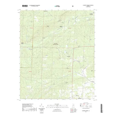
2021 Map of Clairmont Springs
USGS Topo · Published 2021About this map
Clairmont Springs sits at the base of Talladega Mountain, marking a historically significant location within the Talladega National Forest where the ridge meets the valley. This 2021 survey illustrates a landscape defined by sharp elevation changes, particularly around Ironston Gap and Poe Bridge Mountain. The settlement pattern follows the drainages and gaps of the ridge, with communities like Springhill and Gunthertown connected by a network of rural roads such as Idaho Road and Antioch Road.
Find a feature on this map
80 named features on this map. Tap any name to fly to it.
Don’t see what you’re looking for? This feature index may not catch every label — zoom into the map to look around manually.
Map Details
Editions of this 2021 Clairmont Springs Map
This is the sole edition of this map. No revisions or reprints were ever made.
Other maps of this area

1890 · Talladega
USGS Topo · 1:125,000

1891 · Ashland
USGS Topo · 1:125,000

1892 · Talladega
USGS Topo · 1:125,000

1943 · Talladega
USGS Topo · 1:62,500

1944 · Goodwater
USGS Topo · 1:62,500

1946 · Talladega
USGS Topo · 1:62,500

1947 · Goodwater
USGS Topo · 1:62,500

1953 · Birmingham
USGS Topo · 1:250,000

1953 · Atlanta
USGS Topo · 1:250,000

1956 · Birmingham
USGS Topo · 1:250,000