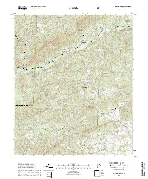
2024 Map of Clairmont Springs
USGS Topo · Published 2024About this map
Talladega Mountain dominates the northern horizon, serving as a backdrop for the community of Clairmont Springs and the winding Talladega Creek. This portion of Clay County is defined by its ridge-and-valley topography, where the Pinhoti National Recreation Trl follows the high ground of the Talladega National Forest. The landscape is dotted with small rural crossroads and settlements such as Gunthertown, Springhill, and Rays Crossroads, illustrating a pattern of development dictated by the mountain gaps and creek basins.
Find a feature on this map
84 named features on this map. Tap any name to fly to it.
Don’t see what you’re looking for? This feature index may not catch every label — zoom into the map to look around manually.
Map Details
Editions of this 2024 Clairmont Springs Map
This is the sole edition of this map. No revisions or reprints were ever made.
Other maps of this area

1890 · Talladega
USGS Topo · 1:125,000

1891 · Ashland
USGS Topo · 1:125,000

1892 · Talladega
USGS Topo · 1:125,000

1943 · Talladega
USGS Topo · 1:62,500

1944 · Goodwater
USGS Topo · 1:62,500

1946 · Talladega
USGS Topo · 1:62,500

1947 · Goodwater
USGS Topo · 1:62,500

1953 · Birmingham
USGS Topo · 1:250,000

1953 · Atlanta
USGS Topo · 1:250,000

1956 · Birmingham
USGS Topo · 1:250,000