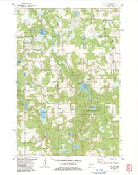
1983 Map of Clam Falls
USGS Topo · Published 1983About this map
The Clam Falls Flowage dominates the central portion of this survey, where the Clam River was harnessed for local use. The small settlement of Clam Falls serves as the focal point of the area, situated near a boat ramp and the river's crossing. To the north, the terrain is dotted with glacial features and named water bodies including Godfrey Lake, Little Deer Lake, and Weiss Lake.
Find a feature on this map
54 named features on this map. Tap any name to fly to it.
Don’t see what you’re looking for? This feature index may not catch every label — zoom into the map to look around manually.
Map Details
Editions of this 1983 Clam Falls Map
This is the sole edition of this map. No revisions or reprints were ever made.
Other maps of this area

1949 · Hertel
USGS Topo · 1:48,000

1950 · Webster
USGS Topo · 1:48,000

1951 · Cumberland
USGS Topo · 1:48,000

1951 · Frederic
USGS Topo · 1:48,000

1953 · Stillwater
USGS Topo · 1:250,000

1955 · Hertel
USGS Topo · 1:62,500

1955 · Webster
USGS Topo · 1:62,500

1955 · Frederic
USGS Topo · 1:62,500

1955 · Stillwater
USGS Topo · 1:250,000

1956 · Cumberland
USGS Topo · 1:62,500