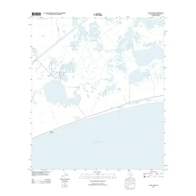
2013 Map of Clam Lake
USGS Topo · Published 2013About this map
Clam Lake Oil Field sits at the heart of this coastal landscape, where industrial extraction meets the expansive wetlands of the Texas Gulf Coast. The terrain is defined by a complex network of brackish waters and marshlands, including Clam Lake, Salt Lake, and the winding Salt Bayou. These waterways served as critical components of the local drainage and transport system long before the establishment of modern conservation areas.
Find a feature on this map
17 named features on this map. Tap any name to fly to it.
Don’t see what you’re looking for? This feature index may not catch every label — zoom into the map to look around manually.
Map Details
Editions of this 2013 Clam Lake Map
This is the sole edition of this map. No revisions or reprints were ever made.
Other maps of this area

1943 · Port Arthur South
USGS Topo · 1:24,000

1944 · Sabine Pass
USGS Topo · 1:31,680

1950 · Houston
USGS Topo · 1:250,000

1954 · Port Arthur
USGS Topo · 1:250,000

1956 · Houston
USGS Topo · 1:250,000
1956 · Port Arthur
USGS Topo · 1:250,000
1957 · Sabine Pass
USGS Topo · 1:62,500
1957 · Sabine Pass
USGS Topo · 1:24,000
1957 · Port Arthur South
USGS Topo · 1:24,000
1957 · Port Arthur
USGS Topo · 1:62,500