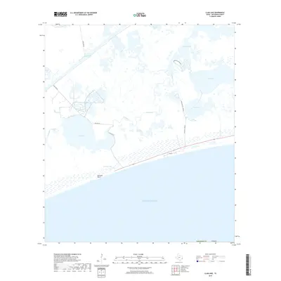
2019 Map of Clam Lake
USGS Topo · Published 2019About this map
McFaddin Beach stretches along the southern edge of this coastal survey, where the Gulf of Mexico meets the expansive marshlands of Jefferson County. The landscape is dominated by an intricate network of lagoons and tidal passages, including the central basin of Clam Lake and the winding Salt Bayou. Human movement through this aqueous environment is primarily dictated by water-based routes, evidenced by the Intracoastal Waterway in the north and several designated paths such as the Advanced Trail, Moderate Trail, and Easy Trail.
Find a feature on this map
22 named features on this map. Tap any name to fly to it.
Don’t see what you’re looking for? This feature index may not catch every label — zoom into the map to look around manually.
Map Details
Editions of this 2019 Clam Lake Map
This is the sole edition of this map. No revisions or reprints were ever made.
Other maps of this area

1943 · Port Arthur South
USGS Topo · 1:24,000

1944 · Sabine Pass
USGS Topo · 1:31,680

1950 · Houston
USGS Topo · 1:250,000

1954 · Port Arthur
USGS Topo · 1:250,000

1956 · Houston
USGS Topo · 1:250,000
1956 · Port Arthur
USGS Topo · 1:250,000
1957 · Sabine Pass
USGS Topo · 1:62,500
1957 · Sabine Pass
USGS Topo · 1:24,000
1957 · Port Arthur South
USGS Topo · 1:24,000
1957 · Port Arthur
USGS Topo · 1:62,500