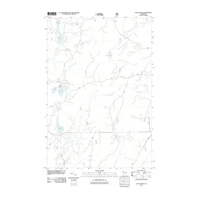
2011 Map of Clam Lake NE
USGS Topo · Published 2011About this map
East Twin Lake Campground serves as a central landmark in this densely forested region of northern Wisconsin, where numerous lakes and drainage networks define the landscape. The hydrography of the area is particularly complex, featuring the winding path of the Brunsweiler River and the uniquely named Dingdong Creek. These waterways, along with Spider Creek and Brush Creek, flow through a territory crisscrossed by forest service roads such as Forest Rd 182 and Forest Rd 195. This 2011 survey captures the area within the Chequamegon-Nicolet National Forest, illustrating the distribution of glacial lakes like Moquah Lake, Spider Lake, and the pair of West Twin Lake and East Twin Lake. Further south, the terrain includes Dead Horse Slough, a distinctive wetland feature situated between the West Torch River and the East Torch River.
Find a feature on this map
26 named features on this map. Tap any name to fly to it.
Don’t see what you’re looking for? This feature index may not catch every label — zoom into the map to look around manually.
Map Details
Editions of this 2011 Clam Lake NE Map
This is the sole edition of this map. No revisions or reprints were ever made.
Other maps of this area

1942 · Glidden
USGS Topo · 1:48,000

1942 · Clam Lake
USGS Topo · 1:48,000

1942 · Mellen
USGS Topo · 1:48,000

1942 · Marengo
USGS Topo · 1:48,000

1945 · Marengo
USGS Topo · 1:48,000

1945 · Clam Lake
USGS Topo · 1:48,000

1945 · Glidden
USGS Topo · 1:48,000

1945 · Mellen
USGS Topo · 1:48,000

1953 · Ashland
USGS Topo · 1:250,000
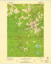
1956 · Mellen
USGS Topo · 1:24,000