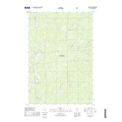
2018 Map of Clam Lake NE
USGS Topo · Published 2018About this map
The Chequamegon National Forest dominates this northern Wisconsin landscape, where a complex network of waterways defines the terrain. The northern reaches are shaped by the Brunsweiler River and Spider Lake, while the southern portion features the meeting of the W Torch River and E Torch River near the winding path of Dingdong Cr. These hydrology patterns illustrate the glacial character of Ashland County, preserved within the protected forest boundaries. Forest Service infrastructure and recreational routes like Dead Horse Run and the Clam Lake Connector provide the primary access through this heavily wooded area. Localized water bodies such as West Twin Lake, East Twin Lake, and the smaller Woodtick Lake are scattered throughout the timberland, connected by seasonal drainages like Spider Cr and Edith Cr.
Find a feature on this map
17 named features on this map. Tap any name to fly to it.
Don’t see what you’re looking for? This feature index may not catch every label — zoom into the map to look around manually.
Map Details
Editions of this 2018 Clam Lake NE Map
This is the sole edition of this map. No revisions or reprints were ever made.
Other maps of this area

1942 · Glidden
USGS Topo · 1:48,000

1942 · Clam Lake
USGS Topo · 1:48,000

1942 · Mellen
USGS Topo · 1:48,000

1942 · Marengo
USGS Topo · 1:48,000

1945 · Marengo
USGS Topo · 1:48,000

1945 · Clam Lake
USGS Topo · 1:48,000

1945 · Glidden
USGS Topo · 1:48,000

1945 · Mellen
USGS Topo · 1:48,000

1953 · Ashland
USGS Topo · 1:250,000
1956 · Mellen
USGS Topo · 1:24,000