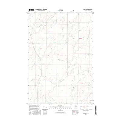
2015 Map of Clam Lake SE
USGS Topo · Published 2015About this map
The Chequamegon National Forest landscape in Ashland County is defined by an intricate network of waterways and a dense system of timber-access roads. The East Fork Chippewa River flows along the southern edge of this area, while the Moose River and W Torch River carve through the northern forest sections. This 2015 survey reflects the contemporary management of the Northwoods, where named arteries like Stock Farm Rd and Birkholz Cut-Off Rd provide the primary human imprint on an otherwise remote forest environment. The map shows the transition of numerous smaller tributaries such as Hungry Run and Black Cr as they feed into the larger river systems, illustrating the complex drainage patterns of this glacial-sculpted terrain. Modern forest management is evidenced by the detailed labeling of numbered fire roads and forest routes that crisscross the townships of T42N and T41N.
Find a feature on this map
30 named features on this map. Tap any name to fly to it.
Don’t see what you’re looking for? This feature index may not catch every label — zoom into the map to look around manually.
Map Details
Editions of this 2015 Clam Lake SE Map
This is the sole edition of this map. No revisions or reprints were ever made.
Other maps of this area

1941 · Kennedy
USGS Topo · 1:48,000

1942 · Glidden
USGS Topo · 1:48,000

1942 · Clam Lake
USGS Topo · 1:48,000

1944 · Draper
USGS Topo · 1:48,000

1945 · Kennedy
USGS Topo · 1:48,000

1945 · Clam Lake
USGS Topo · 1:48,000

1945 · Glidden
USGS Topo · 1:48,000

1947 · Draper
USGS Topo · 1:48,000

1953 · Ashland
USGS Topo · 1:250,000

1953 · Rice Lake
USGS Topo · 1:250,000