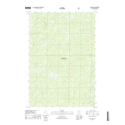
2018 Map of Clam Lake SE
USGS Topo · Published 2018About this map
Chequamegon National Forest encompasses the entirety of this landscape in Ashland County, revealing a complex network of glacial waterways and forest management corridors. The terrain is defined by the winding paths of the E Torch River and W Torch River, which converge in the northern sections of the survey. These rivers, along with smaller tributaries like Hungry Run and Moose River, illustrate the hydraulic character of Northern Wisconsin's timberlands. The presence of named drainages such as Dead Horse Run and Fishtrap Cr suggests a history of local navigation and land use within the protected forest boundaries. While no major townships are centered on this specific sheet, the intricate grid of Forest Service roads and drainage patterns like Holy Cr and Black Cr provides essential detail for understanding the remote topography of the Shanagolden vicinity.
Find a feature on this map
9 named features on this map. Tap any name to fly to it.
Don’t see what you’re looking for? This feature index may not catch every label — zoom into the map to look around manually.
Map Details
Editions of this 2018 Clam Lake SE Map
This is the sole edition of this map. No revisions or reprints were ever made.
Other maps of this area

1941 · Kennedy
USGS Topo · 1:48,000

1942 · Glidden
USGS Topo · 1:48,000

1942 · Clam Lake
USGS Topo · 1:48,000

1944 · Draper
USGS Topo · 1:48,000

1945 · Kennedy
USGS Topo · 1:48,000

1945 · Clam Lake
USGS Topo · 1:48,000

1945 · Glidden
USGS Topo · 1:48,000

1947 · Draper
USGS Topo · 1:48,000

1953 · Ashland
USGS Topo · 1:250,000

1953 · Rice Lake
USGS Topo · 1:250,000