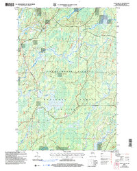
2005 Map of Clam Lake SE
USGS Topo · Published 2006About this map
The Shanagolden area of the Northwoods, situated within the Chequamegon-Nicolet National Forest, is defined by a dense network of watercourses and wetlands that shaped the region's logging and conservation history. This 2005 map, based on data updated through 2006, illustrates the complex hydrology of the East Fork Chippewa River and its numerous tributaries. These include Torch River, Moose River, and smaller streams like Fishtrap Creek and Hungry Run. The landscape is almost entirely managed timberland and protected forest, with few industrial marks other than an occasional Gravel Pit. The map reveals the intricate pattern of township and range boundaries, such as the intersection of T 42 N and T 41 N, which provides a precise grid for locating specific parcels of land within this heavily forested portion of Ashland County.
Find a feature on this map
12 named features on this map. Tap any name to fly to it.
Don’t see what you’re looking for? This feature index may not catch every label — zoom into the map to look around manually.
Map Details
Editions of this 2005 Clam Lake SE Map
This is the sole edition of this map. No revisions or reprints were ever made.
Other maps of this area

1941 · Kennedy
USGS Topo · 1:48,000

1942 · Glidden
USGS Topo · 1:48,000

1942 · Clam Lake
USGS Topo · 1:48,000

1944 · Draper
USGS Topo · 1:48,000

1945 · Kennedy
USGS Topo · 1:48,000

1945 · Clam Lake
USGS Topo · 1:48,000

1945 · Glidden
USGS Topo · 1:48,000

1947 · Draper
USGS Topo · 1:48,000

1953 · Ashland
USGS Topo · 1:250,000

1953 · Rice Lake
USGS Topo · 1:250,000