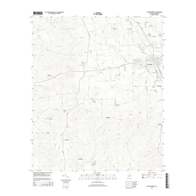
2014 Map of Clanton West
USGS Topo · Published 2014About this map
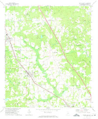
Clanton serves as the focal point for this area of Chilton County, where residential development and municipal infrastructure meet the rural agricultural landscape. The map reveals a high density of burial sites and small community hubs, such as Samaria and Fairview, which are often centered around local landmarks like the Shiloh Baptist Church Cem or Pleasant Grove Cem. The terrain is defined by a dense network of drainage, with Poley Bridge Cr, Goose Pond Cr, and Little Mulberry Cr cutting through the countryside. This 2014 survey documents the western expansion of the county seat while preserving the location of older rural sites, including Old Liberty Hill Cem and Morning Star Cem. The transition from urban streets like Ollie Ave to rural county routes illustrates the enduring character of this Alabama landscape.
Find a feature on this map
133 named features on this map. Tap any name to fly to it.
Don’t see what you’re looking for? This feature index may not catch every label — zoom into the map to look around manually.
Map Details
Editions of this 2014 Clanton West Map
This is the sole edition of this map. No revisions or reprints were ever made.
Other maps of this area

1891 · Clanton
USGS Topo · 1:125,000

1953 · Montgomery
USGS Topo · 1:250,000

1956 · Montgomery
USGS Topo · 1:250,000

1957 · Montgomery
USGS Topo · 1:250,000

1959 · Plantersville
USGS Topo · 1:62,500

1959 · Billingsley
USGS Topo · 1:62,500
1971 · Lay Dam
USGS Topo · 1:24,000
1971 · Maplesville East
USGS Topo · 1:24,000
1971 · Jemison West
USGS Topo · 1:24,000
1971 · Jemison East
USGS Topo · 1:24,000