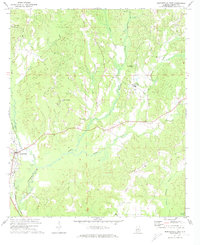
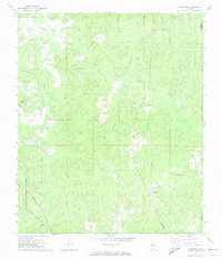
1971 Map of Maplesville East
USGS Topo · Published 1974About this map
Maplesville and its surroundings in Chilton County are defined by a complex intersection of rail and river in the early 1970s. Three distinct rail lines, including the Southern, Gulf Mobile & Ohio, and Illinois Central, converge near the town center, illustrating the area's significance as a mid-century transportation hub. The landscape is carved by the many branches of Mulberry Creek and Benson Creek, where small agrarian settlements like Isabella and Pleasant Hill remain centered around community landmarks. Genealogists will find notable value in the location of the Old Maplesville Cem and several rural sanctuaries, including Mt Carmel Ch and Sardis Ch, which anchor these long-standing communities amidst the timbered hills and scattered Gravel Pits that suggest a quiet, resource-based local economy.
Find a feature on this map
26 named features on this map. Tap any name to fly to it.
Don’t see what you’re looking for? This feature index may not catch every label — zoom into the map to look around manually.
Map Details
Editions of this 1971 Maplesville East Map
2 editions found
Other maps of this area

1891 · Clanton
USGS Topo · 1:125,000

1953 · Montgomery
USGS Topo · 1:250,000

1956 · Montgomery
USGS Topo · 1:250,000

1957 · Montgomery
USGS Topo · 1:250,000

1959 · Plantersville
USGS Topo · 1:62,500

1959 · Billingsley
USGS Topo · 1:62,500
1971 · Jemison West
USGS Topo · 1:24,000

1971 · Maplesville West
USGS Topo · 1:24,000
1971 · Jemison East
USGS Topo · 1:24,000
1971 · Randolph
USGS Topo · 1:24,000