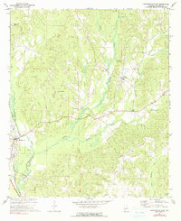
1971 Map of Maplesville East
USGS Topo · Published 1991About this map
Maplesville serves as a primary rail junction in this 1971 survey of central Chilton County, where the Southern, Gulf Mobile and Ohio, and Illinois Central railroads converge. This transit hub anchors a landscape characterized by deep creek valleys and small upland settlements such as Isabella and New Convert. The terrain is carved by the extensive drainage systems of Little Mulberry Creek and Benson Creek, reflecting a rural economy built around timber, transport, and small-scale extraction as evidenced by localized Gravel Pits.
Find a feature on this map
30 named features on this map. Tap any name to fly to it.
Don’t see what you’re looking for? This feature index may not catch every label — zoom into the map to look around manually.
Map Details
Editions of this 1971 Maplesville East Map
2 editions found
Other maps of this area

1891 · Clanton
USGS Topo · 1:125,000

1953 · Montgomery
USGS Topo · 1:250,000

1956 · Montgomery
USGS Topo · 1:250,000

1957 · Montgomery
USGS Topo · 1:250,000

1959 · Plantersville
USGS Topo · 1:62,500

1959 · Billingsley
USGS Topo · 1:62,500
1971 · Maplesville East
USGS Topo · 1:24,000
1971 · Jemison West
USGS Topo · 1:24,000

1971 · Maplesville West
USGS Topo · 1:24,000
1971 · Jemison East
USGS Topo · 1:24,000