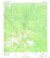
1954 Map of Clara
USGS Topo · Published 1971About this map
The Steinhatchee River carves through the lowlands of North Central Florida in this mid-century survey, defining the border between Taylor, Lafayette, and Dixie counties. The small settlement of Clara and the nearby community of Tennille anchor the local geography, situated along the path of the Atlantic Coast Line railroad. This rail corridor provided a vital link through the dense network of wetlands and creek systems that characterize the region.
Find a feature on this map
16 named features on this map. Tap any name to fly to it.
Don’t see what you’re looking for? This feature index may not catch every label — zoom into the map to look around manually.
Map Details
Editions of this 1954 Clara Map
3 editions found
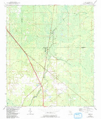
Other maps of this area

1954 · Mallory Swamp NW
USGS Topo · 1:24,000

1954 · Cross City West
USGS Topo · 1:24,000

1954 · Clara
USGS Topo · 1:24,000

1954 · Salem SW
USGS Topo · 1:24,000

1954 · Mallory Swamp SW
USGS Topo · 1:24,000

1954 · Jena
USGS Topo · 1:24,000

1954 · Cooks Hammock
USGS Topo · 1:24,000

1954 · Salem
USGS Topo · 1:24,000

1954 · Steinhatchee
USGS Topo · 1:24,000

1954 · Gainesville
USGS Topo · 1:250,000