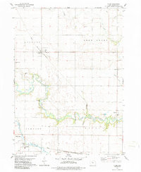
1979 Map of Clare
USGS Topo · Published 1986About this map
The agricultural landscape of Webster County is defined here by the winding course of Lizard Creek and its many small tributaries, which contrast with the rigid grid of rural roads and township boundaries. The town of Clare serves as a local hub, situated at the junction of the Chicago and North Western rail line and a network of secondary roads. Further south, the Illinois Central Gulf railroad skirts the edge of Barnum, illustrating the heavy reliance on rail transport for moving grain and local goods during the late 1970s.
Find a feature on this map
25 named features on this map. Tap any name to fly to it.
Don’t see what you’re looking for? This feature index may not catch every label — zoom into the map to look around manually.
Map Details
Editions of this 1979 Clare Map
2 editions found

Other maps of this area

1923 · Lehigh
USGS Topo · 1:62,500

1923 · Fort Dodge
USGS Topo · 1:62,500

1954 · Fort Dodge
USGS Topo · 1:250,000

1957 · Fort Dodge
USGS Topo · 1:250,000

1958 · Fort Dodge
USGS Topo · 1:250,000

1965 · Moorland
USGS Topo · 1:24,000

1965 · Fort Dodge South
USGS Topo · 1:24,000

1965 · Knierim
USGS Topo · 1:24,000
1979 · Fort Dodge North
USGS Topo · 1:24,000

1979 · Humboldt
USGS Topo · 1:24,000